
At the American Society of Criminology conference in Chicago in a few weeks I will be presenting (I can’t link to the actual presentation it appears, but you can search the program for Wheeler and my session will come up). Don’t take this as a final product, but I figured I would put out there the working paper/chapters of my dissertation that are the motivation for my presentation and my current set of slides.
Here is my original abstract I submitted a few months ago, The title of the talk is The Measurement of Small Place Correlates of Crime;
This presentation addresses several problems related with attempting to identify correlates of crime at small units of analysis, such as street segments. In particular the presentation will focus on articulating what we can potentially learn from smaller units of analysis compared to larger aggregations, and relating a variety of different measures of the built environment and demographic characteristics of places to theoretical constructs of interest to crime at places. Preliminary results examining the discriminant and convergent validity of theoretical constructs pertinent to theories for the causes of crime using data from Washington, D.C. will be presented.
This was certainly an over-ambitious abstract (I was still in the process of writing my prospectus when I submitted it). The bulk of the talk will be focused on “What we can learn from small units of analysis?”, and as of now after that as time allows I will present some illustrations of the change of support problem. Sorry to dissapoint, but nothing about convergent or divergent validity of spatial constructs will be presented (I have done no work of interest yet, and I don’t think I would have time to present any findings in anymore than a superficial manner anyway).
- Here is the working paper, based on two chapters of my dissertation.
- Here is a copy of the presentation and here is the same copy with my notes attached.
Note don’t be scared off by how dull the working paper is, the presentation will certainly be more visual and less mathematical (I will need to update my dissertation to incorporate some more graphical presentations).
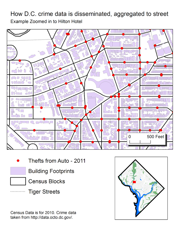
Maps and graphis at the end of the talk demonstrating the change of support problem are still in the works (and I will continue to update the presentation on here). Here is a preview though of the first map I made that demonstrates how D.C. disseminates geo-date aggregated and snapped to street segments, making it problematic to mash up with census data.
The presentation time is on Friday at 9:30, and I’m excited to see the other presentations as well. It looks like to me that Pizarro et al.’s related research was recently published in Justice Quarterly, so if you don’t care for my presentation come to see the other presenters!

