
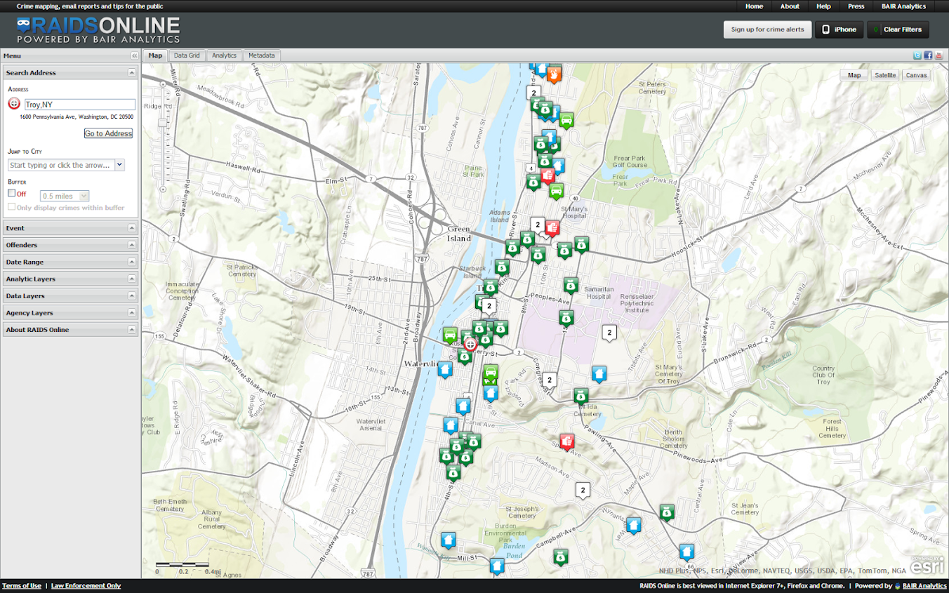
One of the big projects I have been working on since joining the Troy Police Department as a crime analyst last fall is producing timely geocoded data. I am happy to say that a fruit of this labor is the public crime map, via RAIDS Online, that has finally gone public (and can be viewed here). The credit for the online map mainly goes to BAIR Analytics and their free online mapping platform. I merely serve up the data for them to put on the map.
I’ve come to believe that more open data is the way of the future, and in particular an online crime map is a way to engage and enlighten the public to the realities of crime statistics. Although this comes with some potential negative externalities for the police department, such as complaints about innacurracy, decreasing home prices, and misleading symbology and offset geocoding. I firmly believe though that providing this information empowers the public to be more engaged in matters of crime and safety within their communities.
I thank the Troy Police Department for supporting the project in spite of these potential negative consequences, and Chief Tedesco for his continual support of the project. I also thank Capt. Cooney for arranging for all of the media releases. Below is the current online news stories (will update with CW15 if they post a story).
- Troy Police Department launches crime mapping website
- YNN – Police launch crime stat software in Troy
- News10 – Troy becomes second city in NY to use crime mapping software
- WNYT – Computer tool aids Troy Police in crime fighting
Here I end with a list of reading materials I consider necessary for any other crime analyst pondering the decision whether to public crime statistics online. And I end by again thanking Troy PD for allowing me to publish this data, and BAIR for providing the online service that makes it possible with a zero dollar budget.
- Chainey, Spencer & Lisa Tompson. 2012. Engagement, empowerment and transparency: Publishing crime statistics using online crime mapping. Policing 6(3): 228-239.
- Field, Kenneth. 2011. Reflections on a criminal crime map. The Cartographic Journal 48(1): 1-3.
- Groff, Elizabeth R., Brook Kearley, Heather Fogg, Penny Beatty, Heather Couture & Julie Wartell. 2005. A randomized experimental study of sharing crime data with citizens: Do maps produce more fear? Journal of Experimental Criminology 1(1): 87-115. Online PDF Here.
- Ratcliffe, Jerry H. 2002. Damned if you don’t, damned if you do: Crime mapping and its implications in the real world. Policing and Society 12(3): 211-225. Online PDF Here.
- Ratcliffe, Jerry H. 2004. Geocoding crime and a first estimate of a minimum acceptable hit rate. International Journal of Geographical Information Science 18(1): 61-72. Online PDF Here.
- Wartell, Julie & J. Thomas McEwen. 2001. Privacy in the information age: A guide for sharing crime maps and spatial data. U.S. Department of Justice. Office of Justice Programs. National Institute of Justice, Washington, D.C. Online PDF Here.
Let me know if I should add any papers to the list! Privacy implications (such as this work by Michael Leitner and colleagues) might be worth a read as well for those interested. See my geomasking tag at CiteUlike for various other references.


mikeplembeck
/ June 5, 2015The information you provided is very knowledgeable.